This survey is intended to consolidate recent efforts on animal conservation using remote imaging (UAVs, manned flights, or satellite imagery). This page is maintained by Benjamin Kellenberger and Dan Morris. Contributions are welcome! Please submit additions or corrections as GitHub pull requests.
1. Contents
1. Contents
2. Research Articles
3. Case Studies
4. Further Reading
2. Research Articles
Papers are ordered alphabetically by the last name of the first author. If possible, links, images and a brief summary are provided.
The authors employ an ensemble of off-the-shelf Faster R-CNN and YOLO models (predictions fused by averaging) to detect koalas. Noteworthy detail: double-counts due to overlapping images are resolved by finding correspondences (via ORB features) and averaging the detection heatmaps in the overlap zones.
Dataset available on request.
Keywords: deep learning, faster r-cnn, wild mammals
Traditional ML methods (DPM, eSVM) for cattle detection. They also do counting using videos and a KLT tracker. One of the early works, with a straightforward dataset.
Keywords: SVM, tracking, cattle
Comparison of standard detectors (Faster R-CNN, R-FCN, SSD, YOLO) on birds. Interesting detail: they also use bird decoys for data augmentation.
Keywords: deep learning, faster r-cnn, r-fcn, ssd, yolo, birds
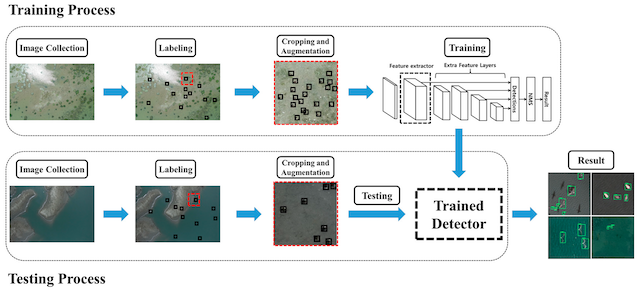
This paper presents tricks to handle the scarcity of animals in UAV imagery.
Dataset freely available.
Keywords: deep learning, resnet, wild mammals
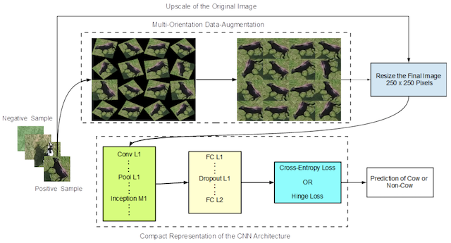
These papers focus on maximizing the variability of the animals a CNN gets to see; the authors position individuals in all rotational variations across the screen, in-painting holes with nearest neighbors.*
Keywords: deep learning, cattle
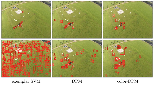
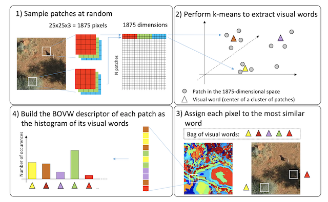
Mammal detection in the African savanna using hand-crafted features (histogram of colors, bag of visual words) and an exemplar SVM.
Keywords: exemplar SVM, wild mammals
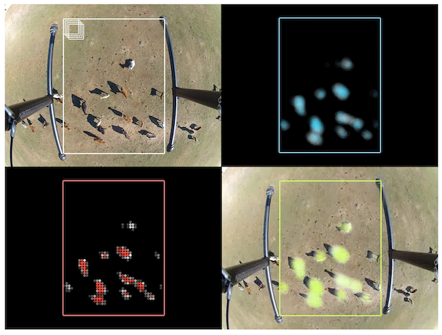
Heatmap-based animal detection in low-altitude imagery that provides relatively clear foreground/background separability. The authors use a custom CNN that is similar to LeNet.
Keywords: deep learning, cattle
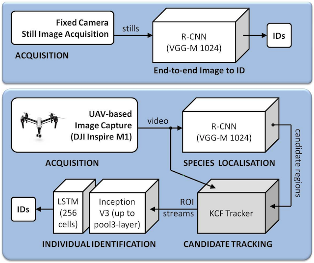
Combination of off-the-shelf models (R-CNN and a KCF tracker) for cattle monitoring.
Keywords: deep learning, kcf, tracking, cattle
This paper does peak finding by thresholding, followed by HOG and SVM, to detect animals in thermal imagery.
Keywords: svm, thermal, cattle
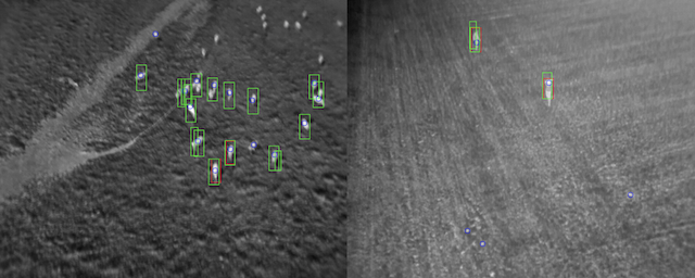
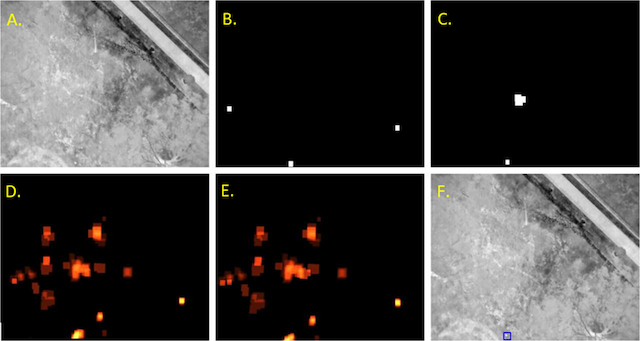
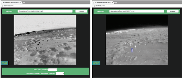
An integrated, cloud-based framework that uses Faster R-CNN on thermal data to localize poachers.
Keywords: deep learning, faster r-cnn, thermal, poaching
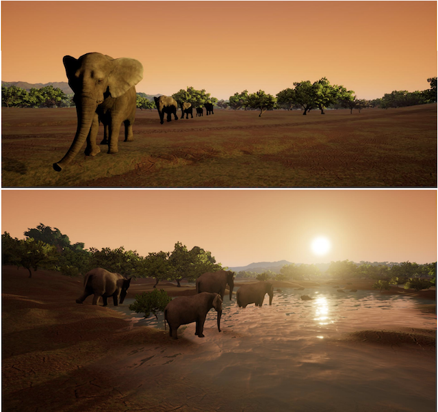
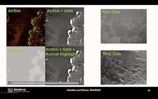
Uses a rendering engine (AirSim, based on the Unreal Engine) to simulate an African ecosystem and derive thermal signatures for detector training.
Keywords: deep learning, thermal, simulation
3. Case Studies
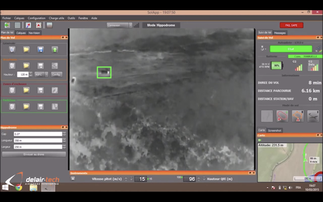
Delair / Bathawk
Collaboration between drone manufacturer Delair and Tanzanian anti-poaching service Bathawk Recon. Used mainly IR footage for detecting poachers and mammals. Presented as a video.
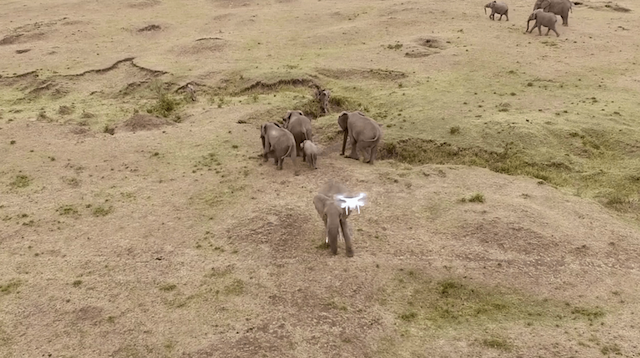
Mara Elephant Project / DJI
Collaboration between the Mara Elephant Project and drone manufacturer DJI. Presented as a video.
Where’s Bunga? Tracking Orangutans with Drones and Gnu-Radio
Technical POC created by Dirk Gorissen in collaboration with International Animal Rescue. Deployed a semi-automatic drone to identify orangutans in the Bornean rainforest.
https://dirkgorissen.com/2019/01/06/wheres-pinoh-tracking-orangutans-with-drones-and-gnu-radio
https://dirkgorissen.com/2016/04/19/wheres-susi-airborne-orangutan-tracking-with-python-and-react-js
JGI / ConservationDrones.org
Collaboration between the Jane Goodall Institute of Canada and ConservationDrones.org to explore drone use in a Congolese reserve. Mentioned applications include censuses of chimpanzees. Presented as a video.
Deep Reality Simulation for Automated Poacher Detection
Leverages AirSim-W (see paper by Bondi et al. above) to generate synthetic thermal imagery for training poacher detection models. Uses Faster R-CNN, domain adaptation using GANs, and an implementation using MS Azure and Apache Spark.
https://databricks.com/session/distributed-deep-domain-adaptation-for-automated-poacher-detection
Also see accompanying video.
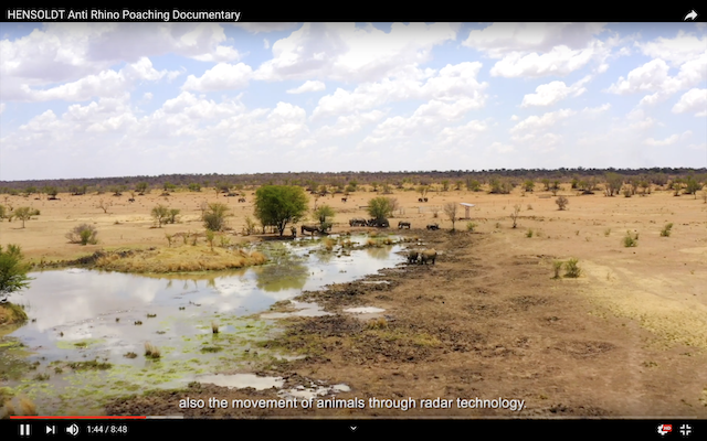
Hensoldt
German sensor manufacturer Hensoldt presents a program intended to stem rhino poaching in South Africa in this video.
4. Further Reading
ConservationDrones.org blog: applications (incredible collection of additional case studies)
ConservationDrones.org blog: publications (incredible collection of additional research papers)
Awesome Deep Ecology (review of deep learning applications in ecology)
Camera Trap ML Survey (analogous list for camera traps)